Snow Hill, Maryland
William (W?) Shankland came to America around the 1680's and settled first in
 Snow
Hill Maryland. There are several important documents in the Maryland State
Archives proving this fact. One shows that he signed an oath of loyalty to the King and Queen of
England in 1689, the first official record of his appearance in this Country and
Somerset County MD. He purchased 300 acres of land called Parker's adventure in
1694. In 1704 he purchased 300 acres in Lewes, Delaware (pronounced Lewis) and in 1714 he
signed a power of attorney along with his wife Elizabeth selling that property
to John Dreden for 9000 pounds of tobacco. The English made it difficult to
obtain cash currency and many things were sold for commodities. Hypothetically
he may have shipped this tobacco to England in exchange for household goods,
clothing, and farming tools. Snow
Hill Maryland. There are several important documents in the Maryland State
Archives proving this fact. One shows that he signed an oath of loyalty to the King and Queen of
England in 1689, the first official record of his appearance in this Country and
Somerset County MD. He purchased 300 acres of land called Parker's adventure in
1694. In 1704 he purchased 300 acres in Lewes, Delaware (pronounced Lewis) and in 1714 he
signed a power of attorney along with his wife Elizabeth selling that property
to John Dreden for 9000 pounds of tobacco. The English made it difficult to
obtain cash currency and many things were sold for commodities. Hypothetically
he may have shipped this tobacco to England in exchange for household goods,
clothing, and farming tools.
The method used for surveying property is the English metes and bounds system
where the perimeter of the property is described by angles and lengths. 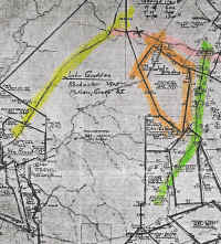 It
is usually referenced by a known survey to a neighbors property and some non-permanent
marker like an Oak Tree. Unfortunately this makes it very difficult to determine
where that property is located today. It
is usually referenced by a known survey to a neighbors property and some non-permanent
marker like an Oak Tree. Unfortunately this makes it very difficult to determine
where that property is located today.
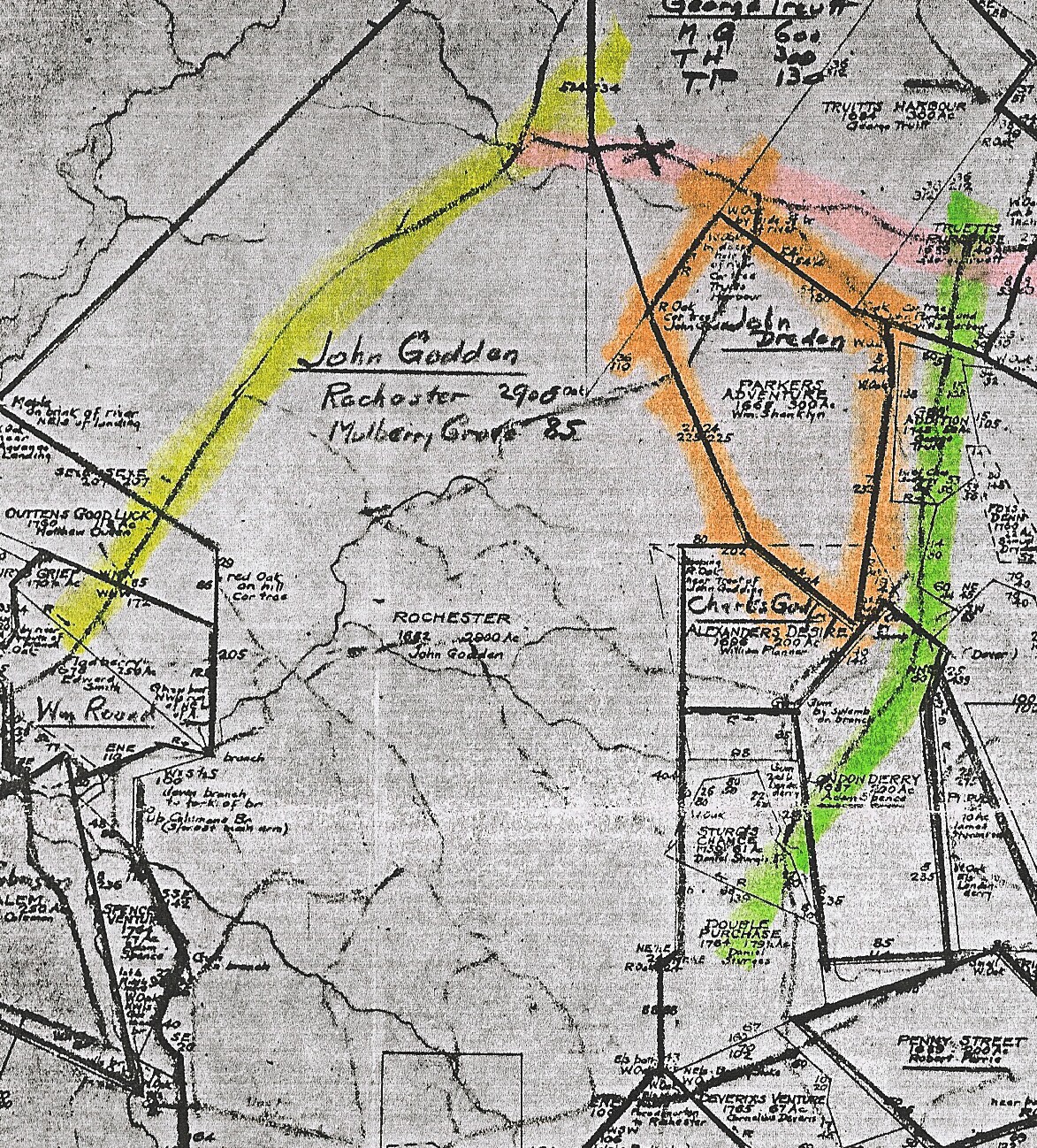
In 1930 Harry Benson from the Maryland Archives
undertook a project to study all of the ancient original Lord Baltimore land
grants and drew them on a modern map. 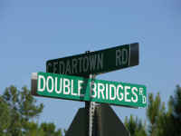 Thanks to this work it is possible to find
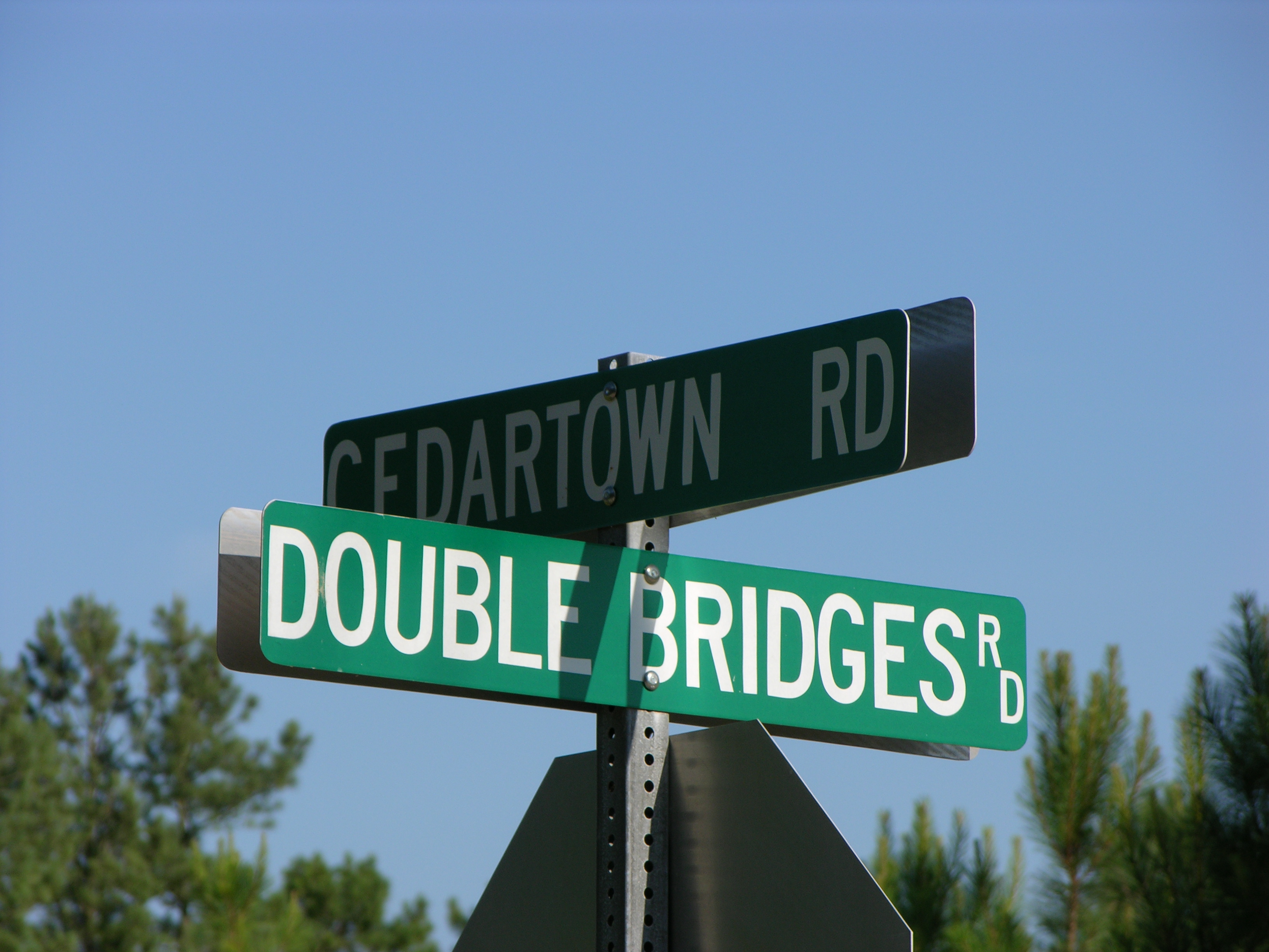
William's first piece of property. It is located on the Southwest corner of Cedartown
Rd and Double Bridges Rd
about 3 miles Northeast of Snow Hill. Modern records show that it is private property, owned by two different
individuals and consists of farm crops and woods. Thanks to this work it is possible to find
William's first piece of property. It is located on the Southwest corner of Cedartown
Rd and Double Bridges Rd
about 3 miles Northeast of Snow Hill. Modern records show that it is private property, owned by two different
individuals and consists of farm crops and woods.
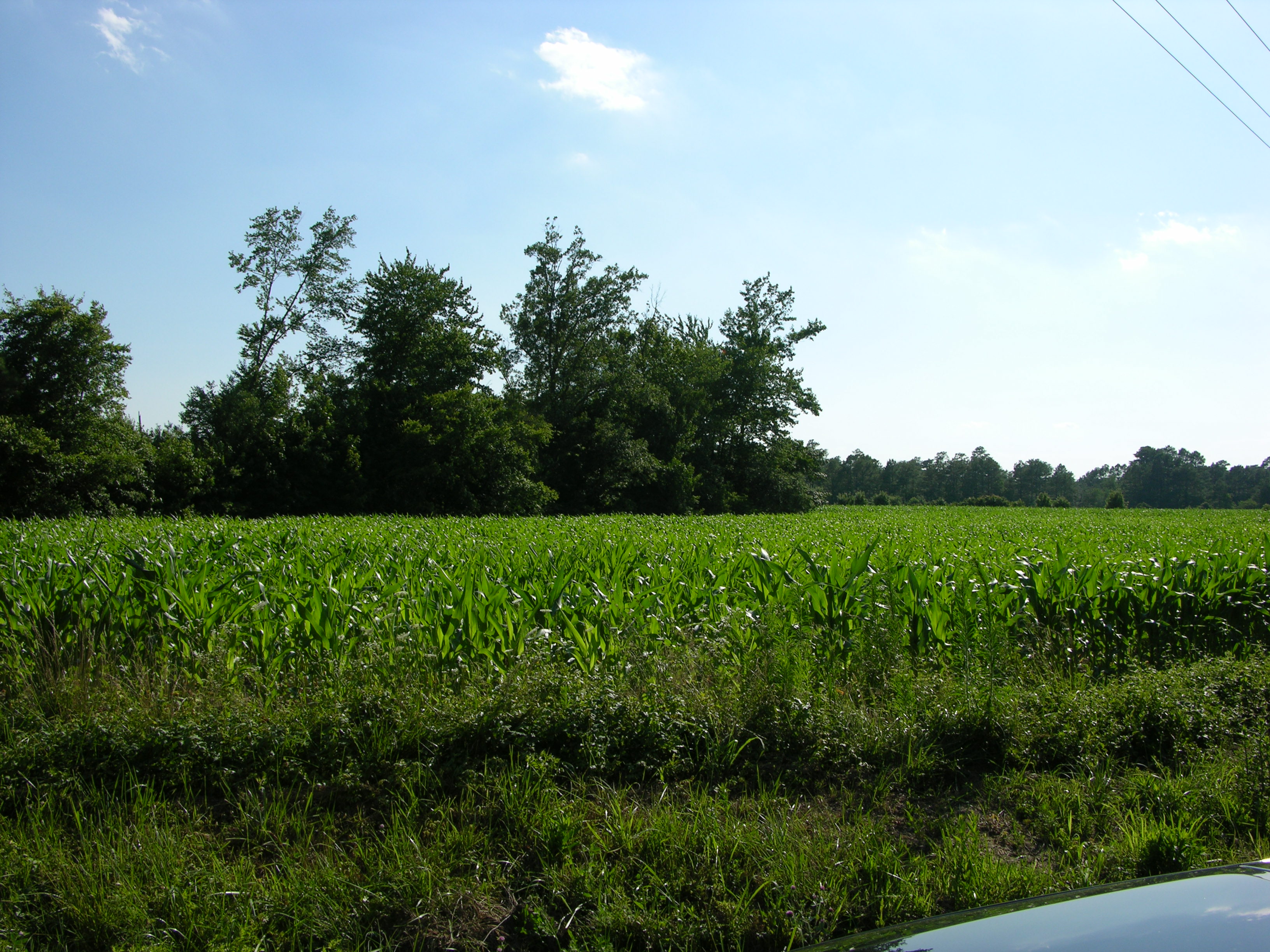
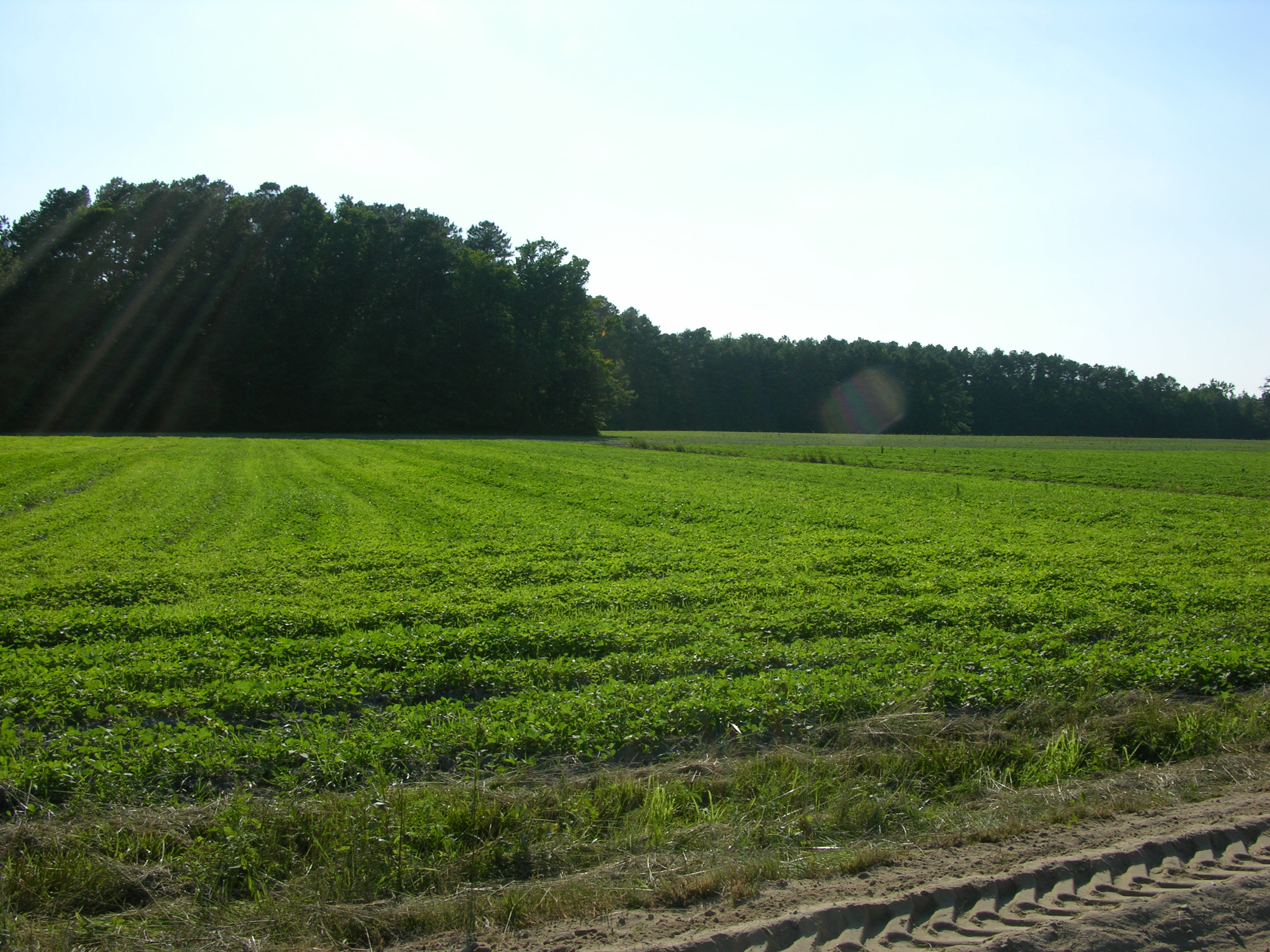
The property runs for approximately 3/4 mile along Cedartown and one mile
along Double Bridges. It is difficult to determine by casual observation if it
actually extends to the roads. It was not unusual to leave some of the property
in woods. It provided fire wood, game, nuts, fruits, and lumber.
 |
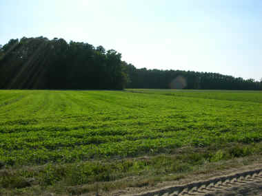 |
| Corn and woods from Cedartown Rd and Double
Bridge Rd looking Northwest. |
Soybeans and woods from Double Bridge Rd
looking Northeast. |
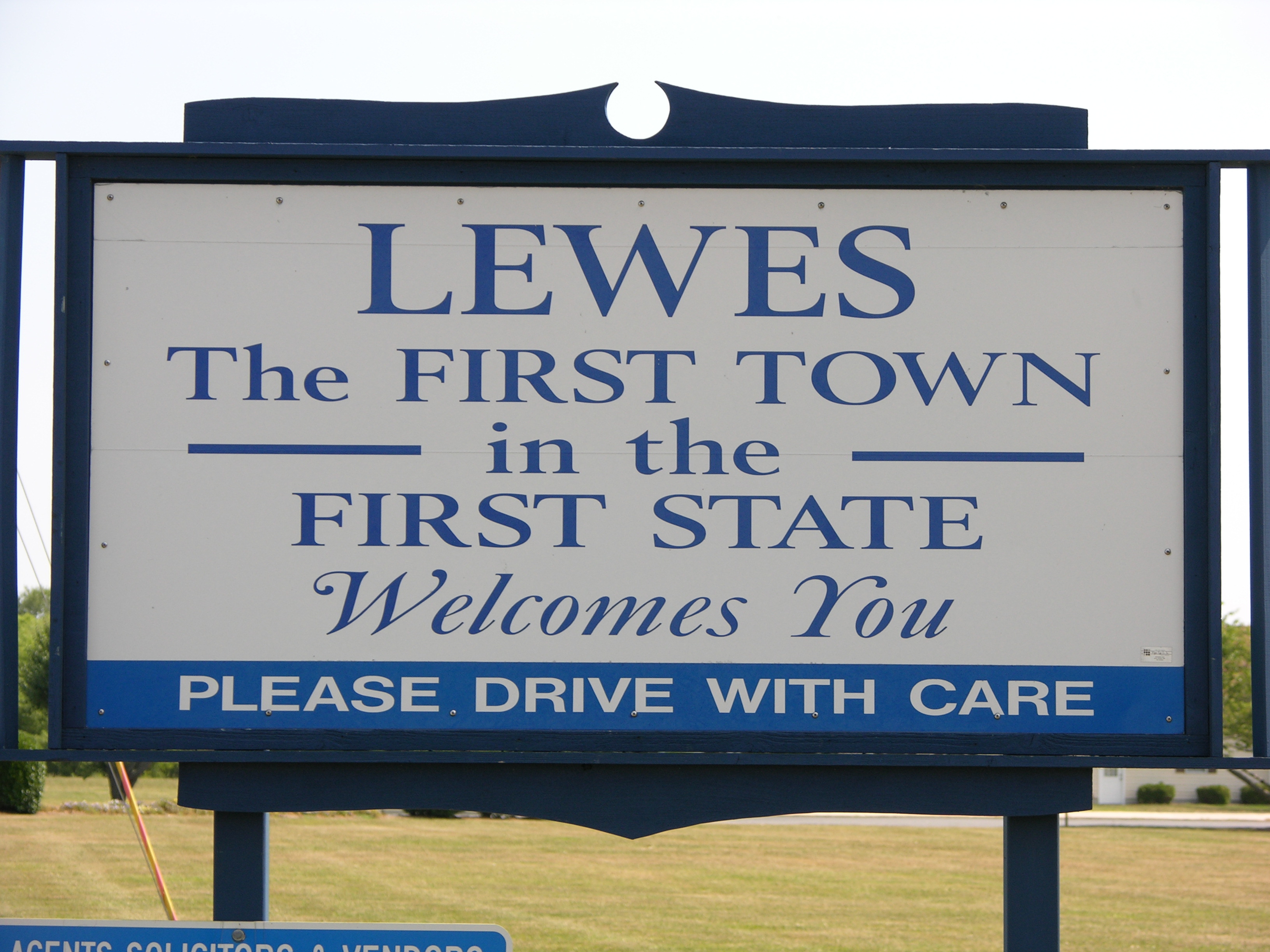
Lewes, Delaware
Lewes (pronounced Lewis) is located on the mouth of Delaware bay making it a
seaport and a city conveniently located by water to Philadelphia. 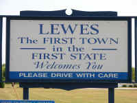 This
arrangement offered many more opportunities for settlers than some of the inland
cities and areas. Many people relocated here from Maryland. Today it is a
wonderful, well preserved, city with a great sense of historical pride. The
Lewes Historical Society has been able to purchase some of the significant
buildings and has opened them as individual museums. In addition there is a one
square block area called Carpenters Square that is zoned for historical
buildings owned by individuals and relocated to this block. An unusual local
custom has been to pickup these small homes and move them to another site. As a
result many historic properties have been saved. This
arrangement offered many more opportunities for settlers than some of the inland
cities and areas. Many people relocated here from Maryland. Today it is a
wonderful, well preserved, city with a great sense of historical pride. The
Lewes Historical Society has been able to purchase some of the significant
buildings and has opened them as individual museums. In addition there is a one
square block area called Carpenters Square that is zoned for historical
buildings owned by individuals and relocated to this block. An unusual local
custom has been to pickup these small homes and move them to another site. As a
result many historic properties have been saved.
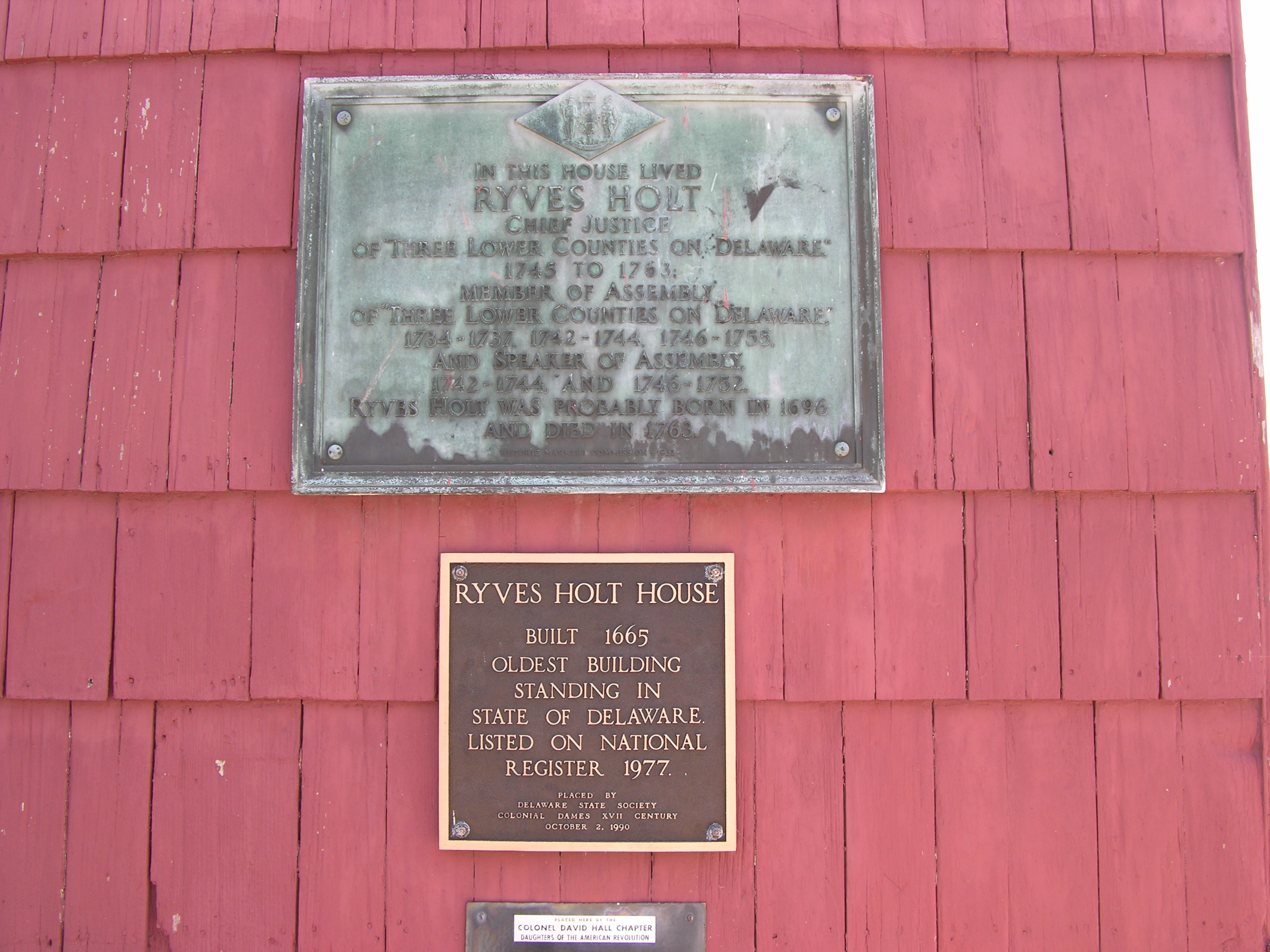
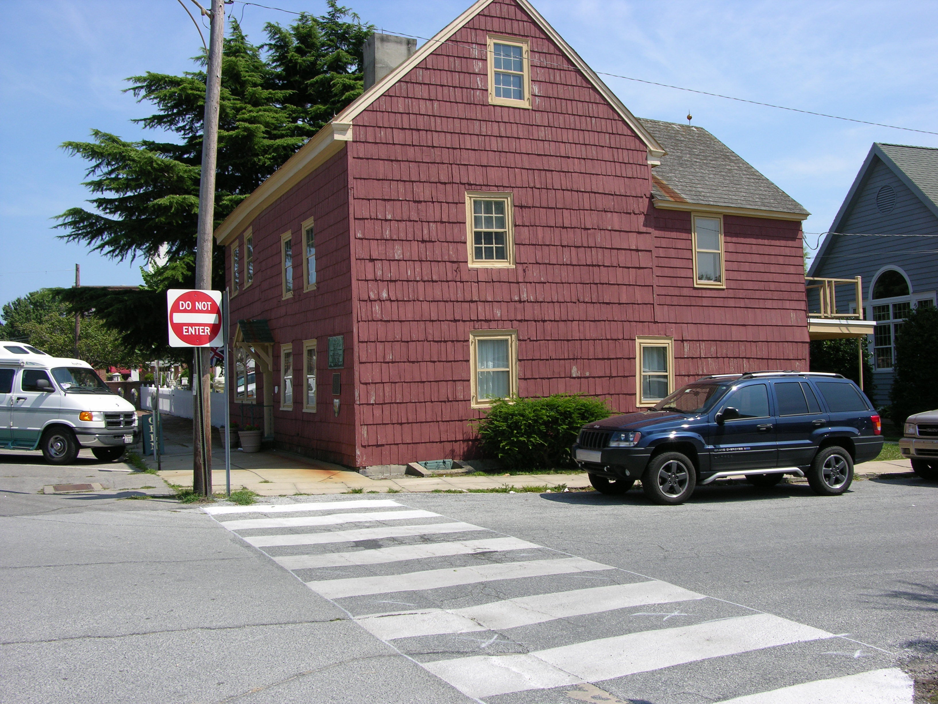
The oldest structure 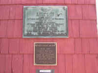 still
standing in the State of Delaware is the Ryves Holt House in downtown Lewes.
Built in 1665 it was used for many things over the year including a bar. During
the earliest days it served as a local court house for legal matters. The
Shankland family still
standing in the State of Delaware is the Ryves Holt House in downtown Lewes.
Built in 1665 it was used for many things over the year including a bar. During
the earliest days it served as a local court house for legal matters. The
Shankland family
 held
many important positions and were prominent land holders. There can be no
question that that were in and out of this house constantly over the
years. held
many important positions and were prominent land holders. There can be no
question that that were in and out of this house constantly over the
years.
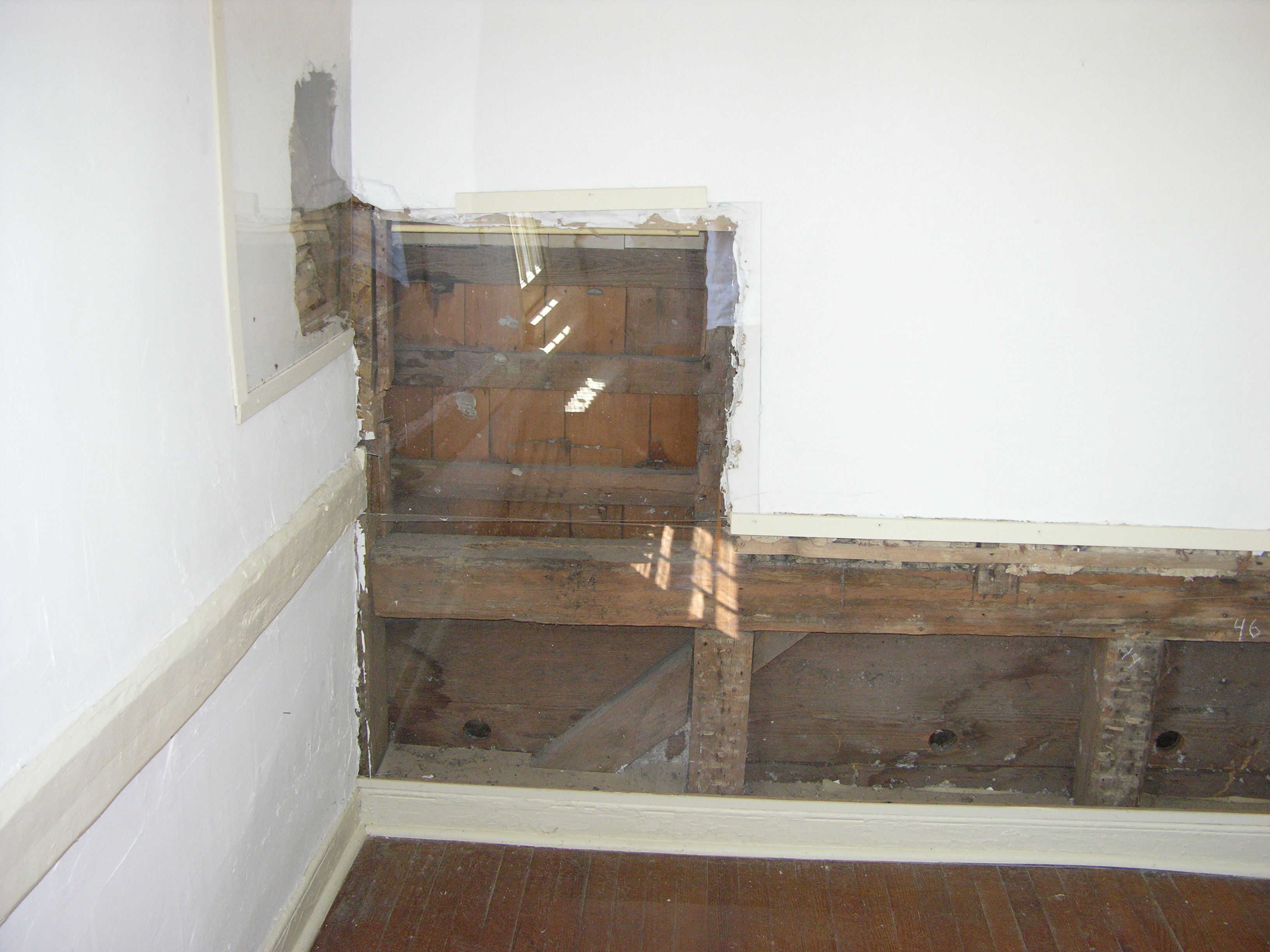
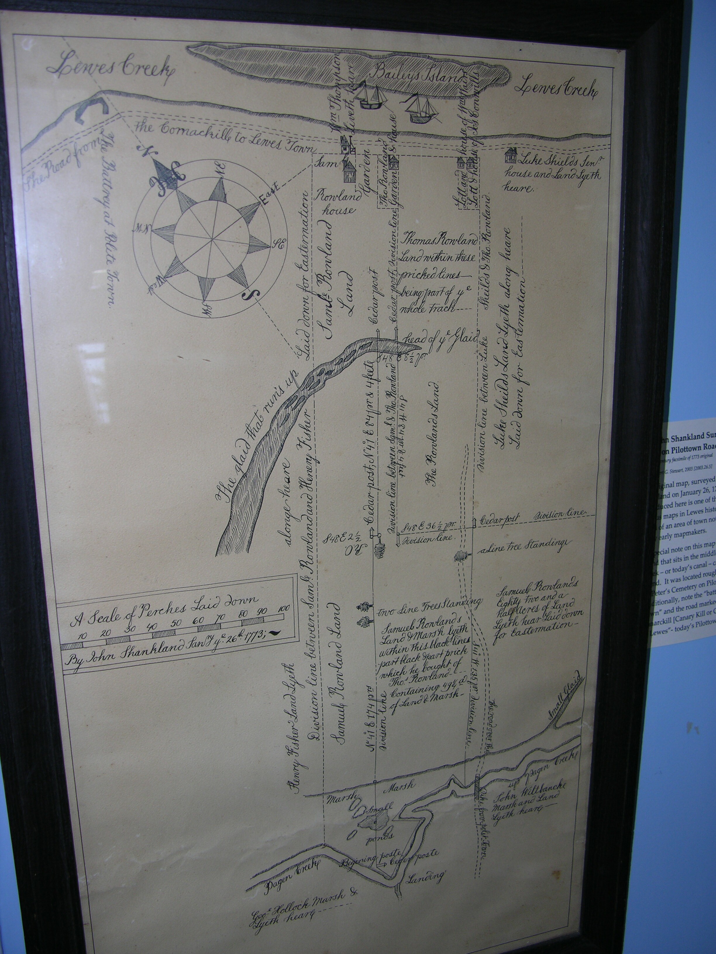
Inside the home are many artifacts, not necessarily related to the house, but
historically interesting. Several sections of the walls were covered with Plexiglas
during the restoration to show construction methods. One is a survey by John
Shankland drawn in 1773 and later printed and used as a map of this area along Lewes Creek.
Ralph Prettyman a descendant of the historic Prettyman family has written a
history of Tower Hill and includes families that were neighbors or connected to
the Prettymans including Rhoads Shankland.  Rhoads
was the most prominent Shankland of Lewes and was the great-grandson of William
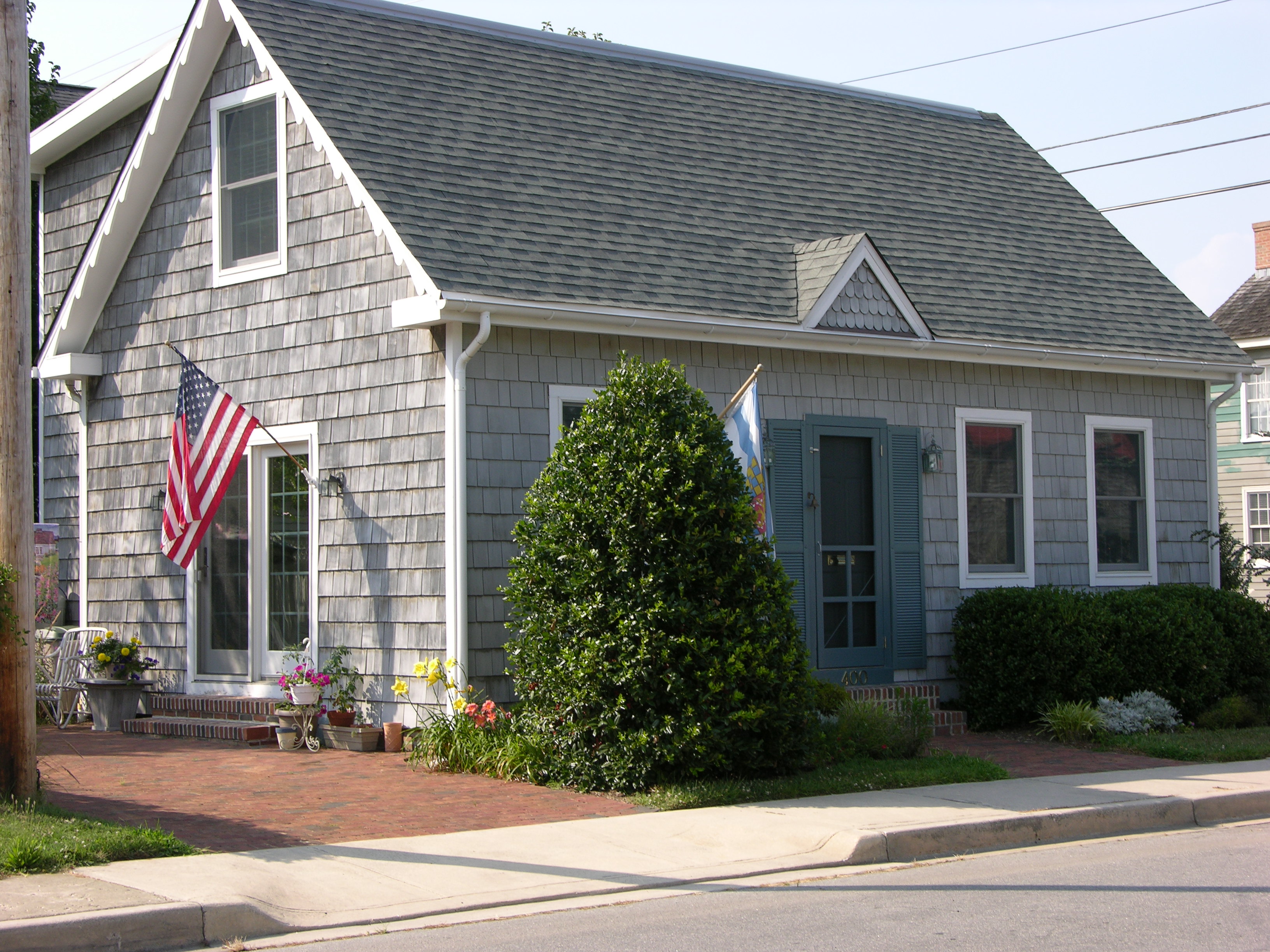
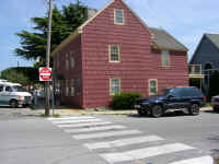
through his son Robert. Across the street Rhoads
was the most prominent Shankland of Lewes and was the great-grandson of William
through his son Robert. Across the street from Carpenters Square is the "Rhoads Shankland House" relocated from
its original location (maybe more than once). Ralph theorizes that
this may not be Rhodes home due to some surveys that he has located but the
possibility exists that it could have been an even earlier Shankland
home.
from Carpenters Square is the "Rhoads Shankland House" relocated from
its original location (maybe more than once). Ralph theorizes that
this may not be Rhodes home due to some surveys that he has located but the
possibility exists that it could have been an even earlier Shankland
home.
On 1/25/1771 Rhoads purchased from Joseph and Samuel Shankland for 1200
pounds a 410 acre tract of land Called St Martins. This piece of property had
the following history. Granted by patent to Edward southern on 1/15/1675 his
widow Mary sold it to Griffith Jones on 3//6/1685, who in turn sold it to Samuel
Preston. Scharf, in his history of Delaware, states that "One
of the first five property transactions between private parties in the State of
Delaware was the purchase of 400 acres on Pagen Creek by William Shankland from
Samuel Preston. This Tract of land was called St. Martins and through it was
afterwards located the Well known Shankland's Lane." (The Main Street into
town. JNS). William willed this property to his son Joseph and it eventually
went to his sons. By later surveys it is possible to see where St Martins is
currently located. The area today know as Quakertown, formerly Prettymanville,
occupies the former Shankland property.
Rhoads donated land to the
Ebenezer Methodist Church for a cemetery and his wife Mary Stockley and son
Rhoads B Shankland is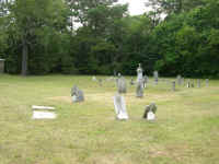 buried there along with many other people. This cemetery exists today and is
located along Savannah Road (formerly Shankland's Lane) . Stand there, facing
south, and all before you was St. Martins on Pagen Creek. The property
buried there along with many other people. This cemetery exists today and is
located along Savannah Road (formerly Shankland's Lane) . Stand there, facing
south, and all before you was St. Martins on Pagen Creek. The property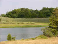 was on both sides of the road but more on the West side.
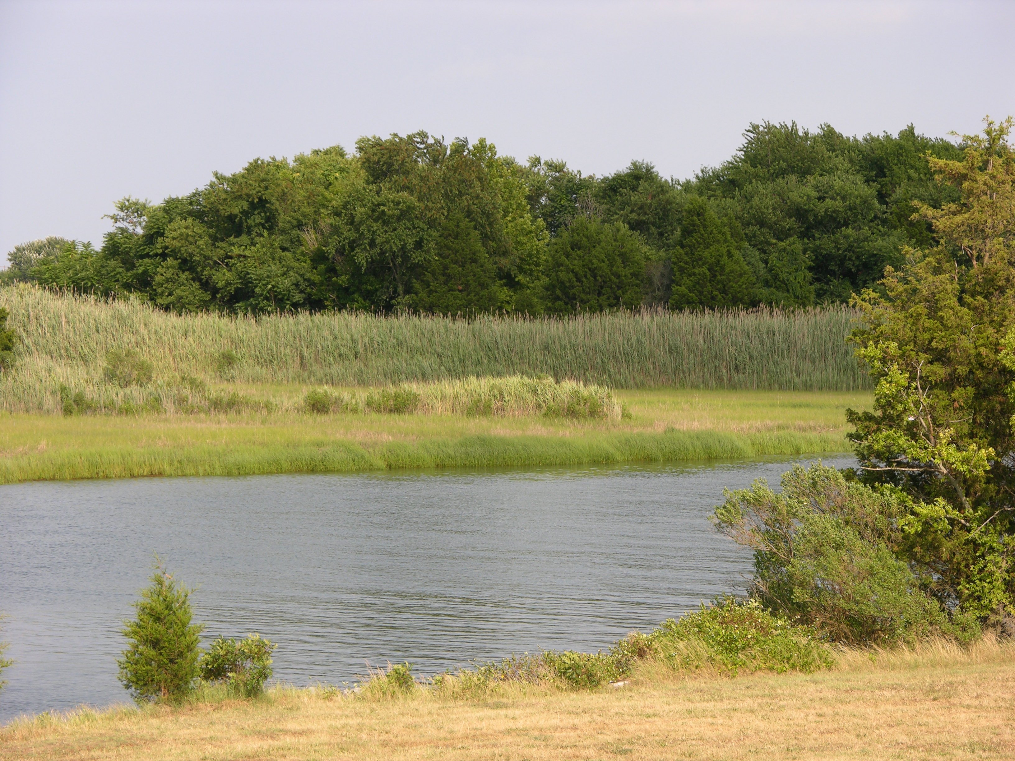
When William died ca 1730 he owned over 1200 acres of land. One of his
purchases was an Island of Marsh in Lewes Creek, later called Shankland's
Island. This island was also passed down through the generations until it was
dredged out during the construction of the Lewes-Rehoboth Canal. This island
could have been used for grazing cattle, hunting, and/or harvesting "Marsh
Hay". The photo depicts the north shore of the Canal just west of town and
either is representative of what it looked like or possibly a remaining part of
it.
Williams will gives his plantation in Angola Neck to his son William. 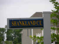 The
present location of this property is unknown to me at this time but it is south
of Rehoboth Beach. Interestingly there is a street in the approximate area called
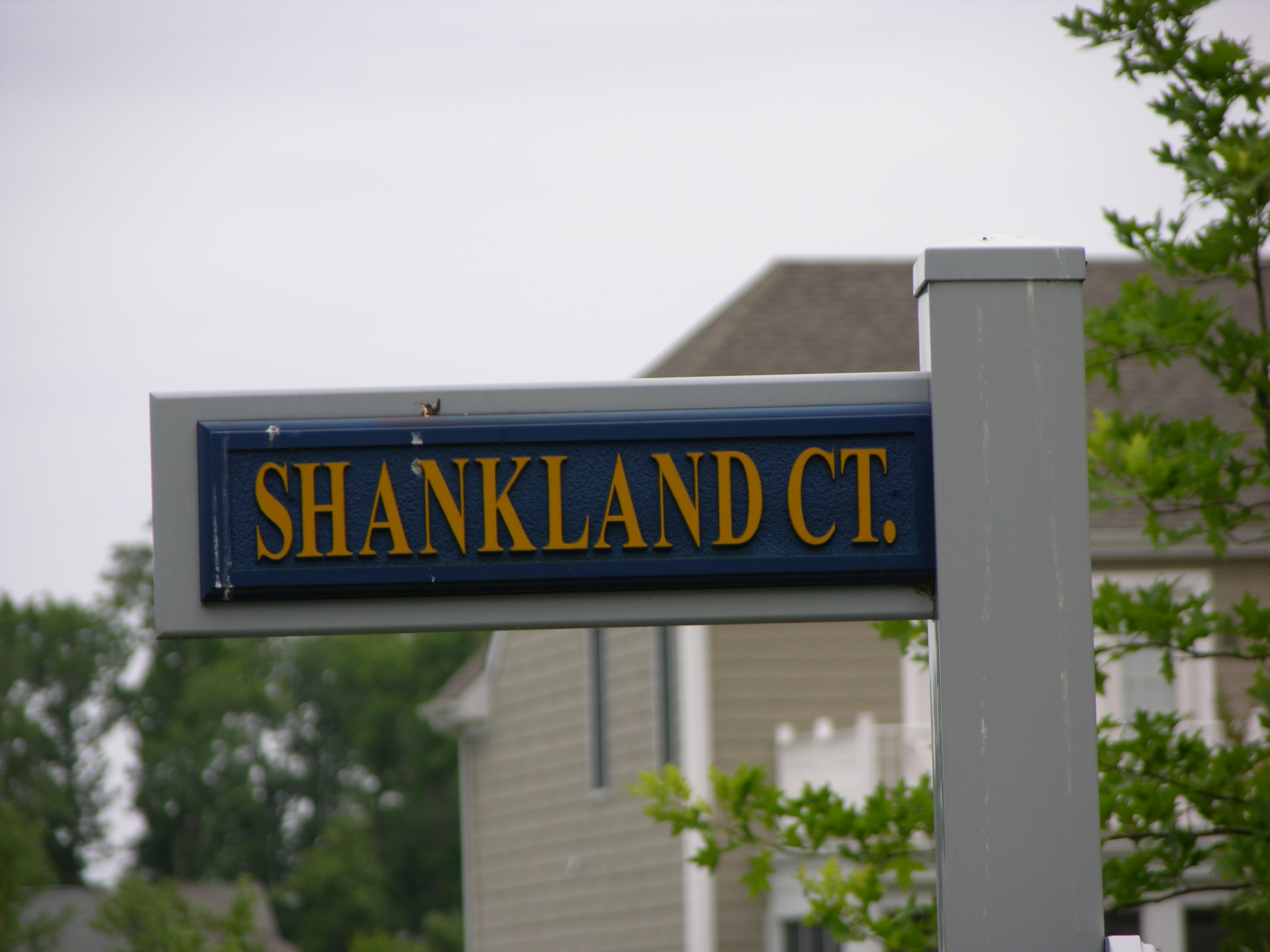
Shankland's court but I have no information on why. The
present location of this property is unknown to me at this time but it is south
of Rehoboth Beach. Interestingly there is a street in the approximate area called
Shankland's court but I have no information on why.
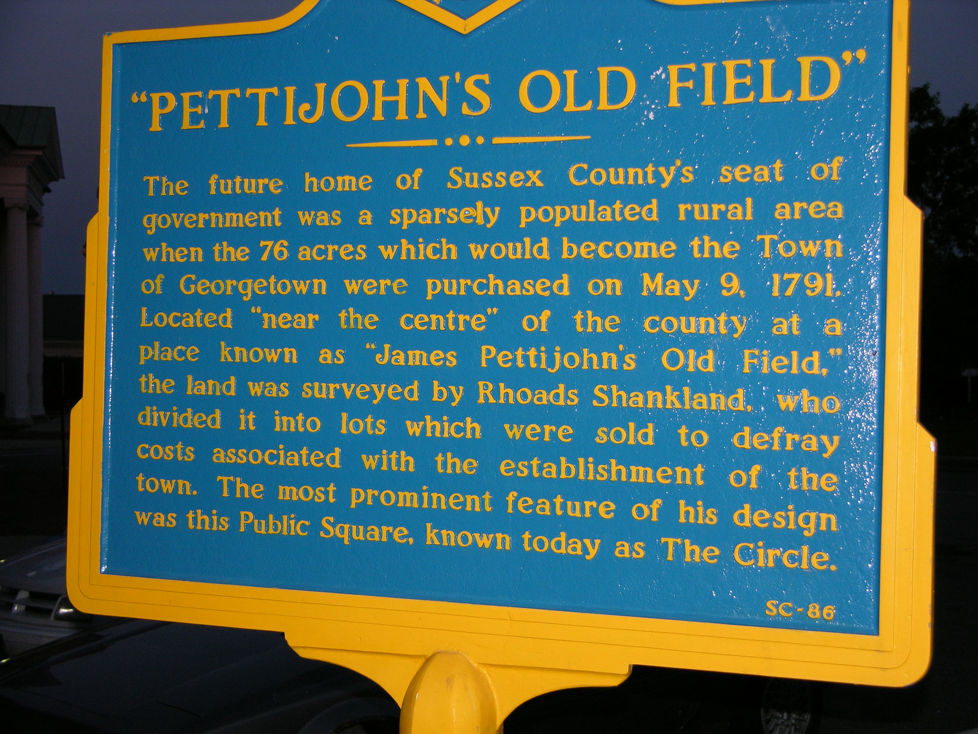
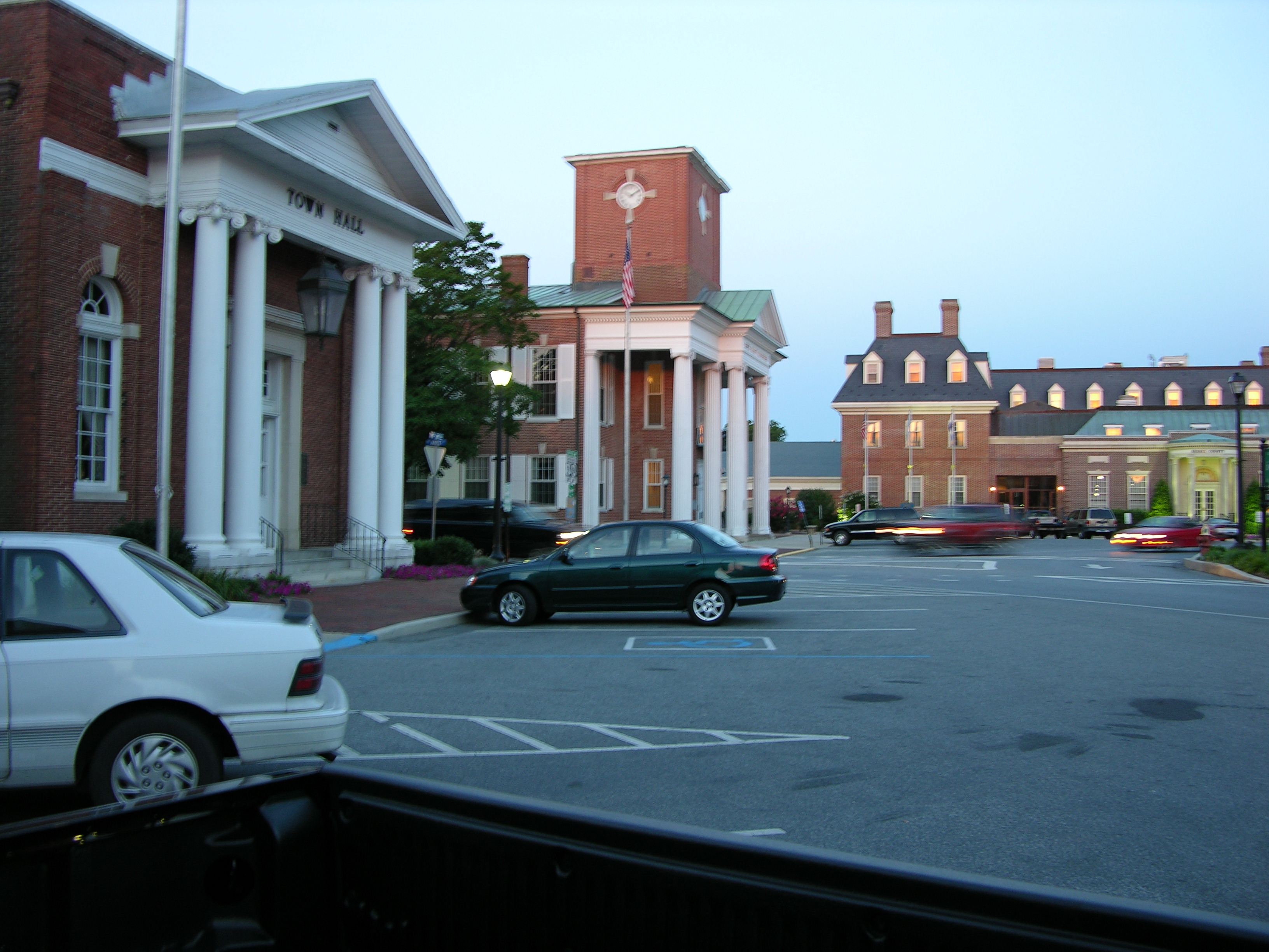
Rhoads 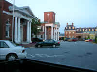 among
many other things was a surveyor and laid out the town of George Town. among
many other things was a surveyor and laid out the town of George Town.
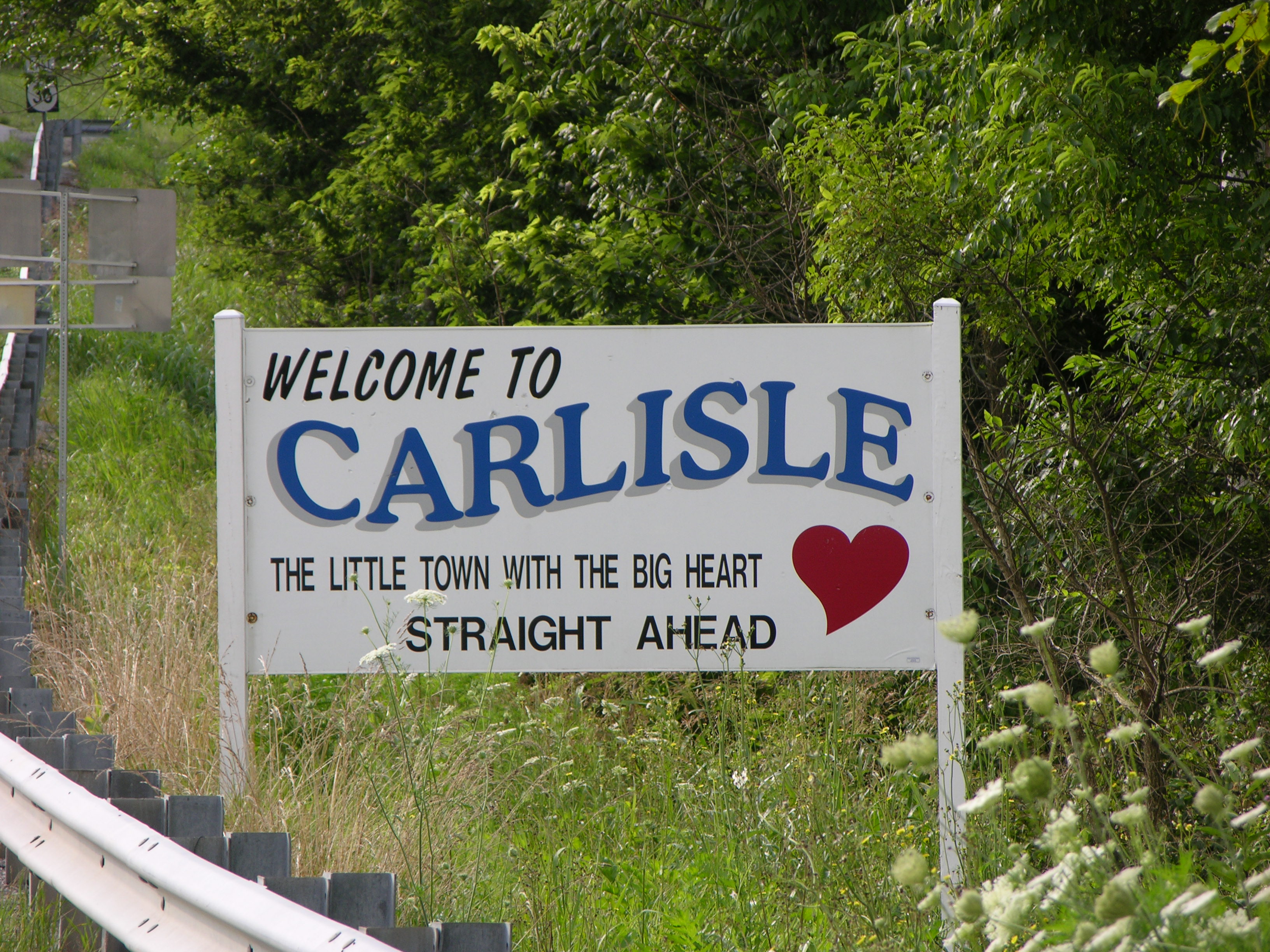
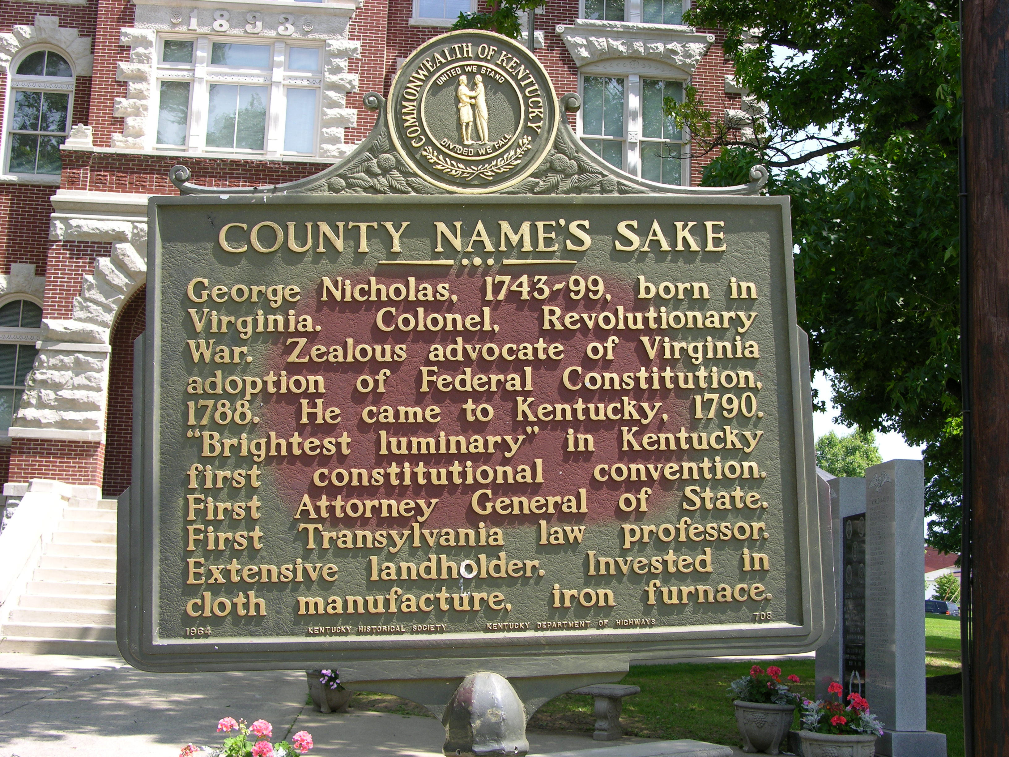
Carlisle, Kentucky
Most of the forth generation of Shankland's left Lewes, Delaware during the
time frame of 1790 to 1820 or so. The 1820 census show few Shanklands left in Delaware.
Joseph's grandchildren went to Philadelphia. Roberts grandson Rhoads
stayed until his death but his family left for Ohio near or after his death in
1816. 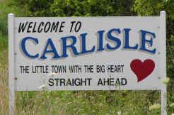 William
only had a Granddaughter who married a Burton and Marsh. Some of those
descendants stayed in Delaware on the plantation in Angola Neck. Johns grandsons
John and David migrated to outside of Carlisle, KY along Cassidy creek near
Myers Station. William
only had a Granddaughter who married a Burton and Marsh. Some of those
descendants stayed in Delaware on the plantation in Angola Neck. Johns grandsons
John and David migrated to outside of Carlisle, KY along Cassidy creek near
Myers Station.
The exact timeframe is not know nor exactly how they got there. Some pioneers
went north to the Susquehanna River and floated down it on flat boats to the
Ohio and into the Licking river. Others came overland possibly by wagon or
horseback through the Cumberland gap possibly on the Bradock road. John's 5th
child David was born April 9th 1795 in  Nicholas
County, KY while the first 4 children and his wife Sarah "Sally"
Harney were all born in Delaware. John and his family must have arrived by 1794.
John had nine children and all of them left Kentucky as adults. Nicholas
County, KY while the first 4 children and his wife Sarah "Sally"
Harney were all born in Delaware. John and his family must have arrived by 1794.
John had nine children and all of them left Kentucky as adults.
During the early time there were still a few skirmishes with the Indians and Daniel
Boone lived in Nicholas Co. with his family for one year.
More research on this area should be done but I assume that John bought a
small piece of property along Cassidy creek and raised and supported his family
on it. Farms were small and hardly more than large gardens used for the families
needs. Their subsistence was supplemented by game, wild fruit, and vegetables.
In 1813 John bought another 100 acres of land from Michael Cassidy, presumably
from the Cassidy creek Cassidys. 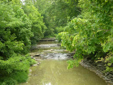 This
land was woods which was either partially cleared or had some small fields.
Woods were valuable for food, medicine, lumber and firewood. Later, after Thomas
Jefferson bought the Louisiana Territory from France in 1803 for $13 million
dollars ($.03 per acre) it was possible to ship goods to New Orleans via
the Licking, Ohio, and Mississippi Rivers. This allowed people in the Cassidy
creek community to raise much needed cash crops such as tobacco. This
land was woods which was either partially cleared or had some small fields.
Woods were valuable for food, medicine, lumber and firewood. Later, after Thomas
Jefferson bought the Louisiana Territory from France in 1803 for $13 million
dollars ($.03 per acre) it was possible to ship goods to New Orleans via
the Licking, Ohio, and Mississippi Rivers. This allowed people in the Cassidy
creek community to raise much needed cash crops such as tobacco.
James Harvey and Andrew Gibb Shankland, the two youngest children,
inherited their father's farm after his death in 1834 but could not sell it
until after the death of their mother Sally. John's will leaves each of his
other adult children $.50. It was not unusual to help each child as they got
married and therefore not leave them an inheritance.
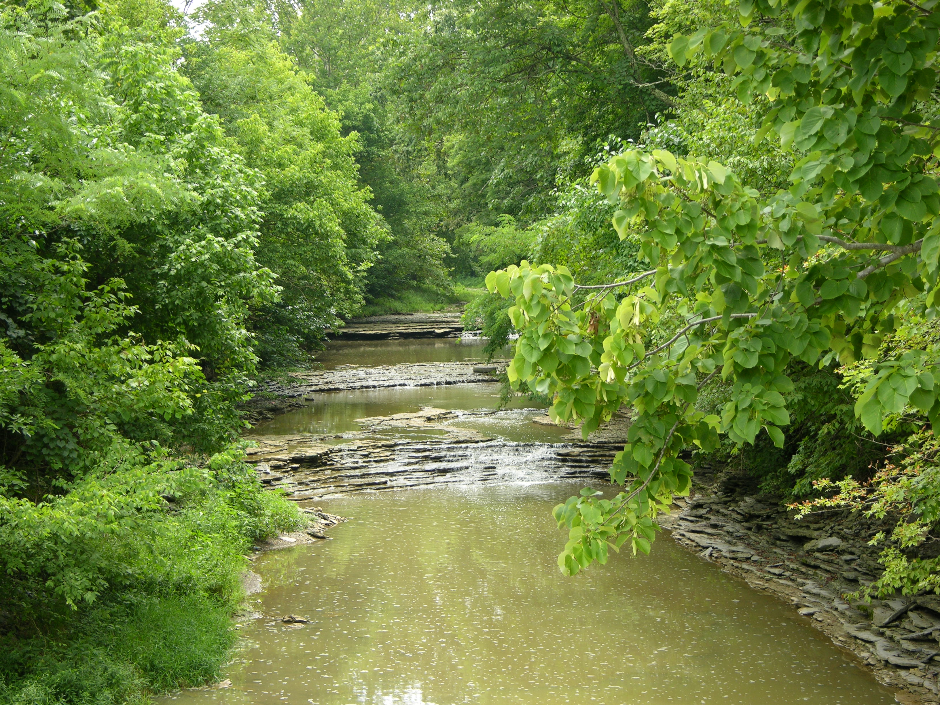
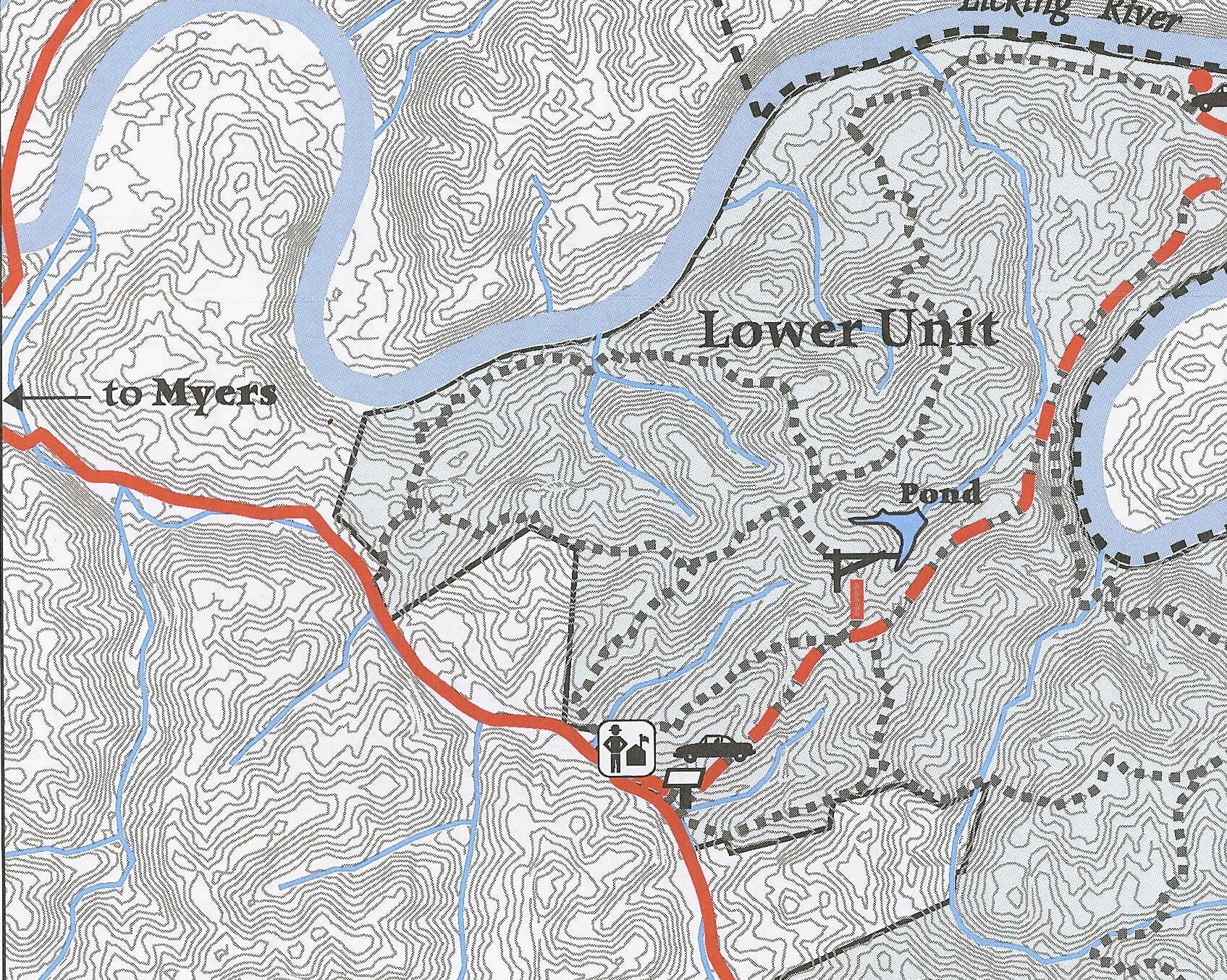
The WMA (Wildlife Management Area) , part of the Kentucky Fish and Game department,
 had purchased the large Clay
farm along the Cassidy creek. (The upper unit) and later added a smaller farm
(the lower unit) to its holdings. This lower unit contains all or part of
the 169 acre farm sold by James and Andrew Shankland to John Stoops. had purchased the large Clay
farm along the Cassidy creek. (The upper unit) and later added a smaller farm
(the lower unit) to its holdings. This lower unit contains all or part of
the 169 acre farm sold by James and Andrew Shankland to John Stoops.
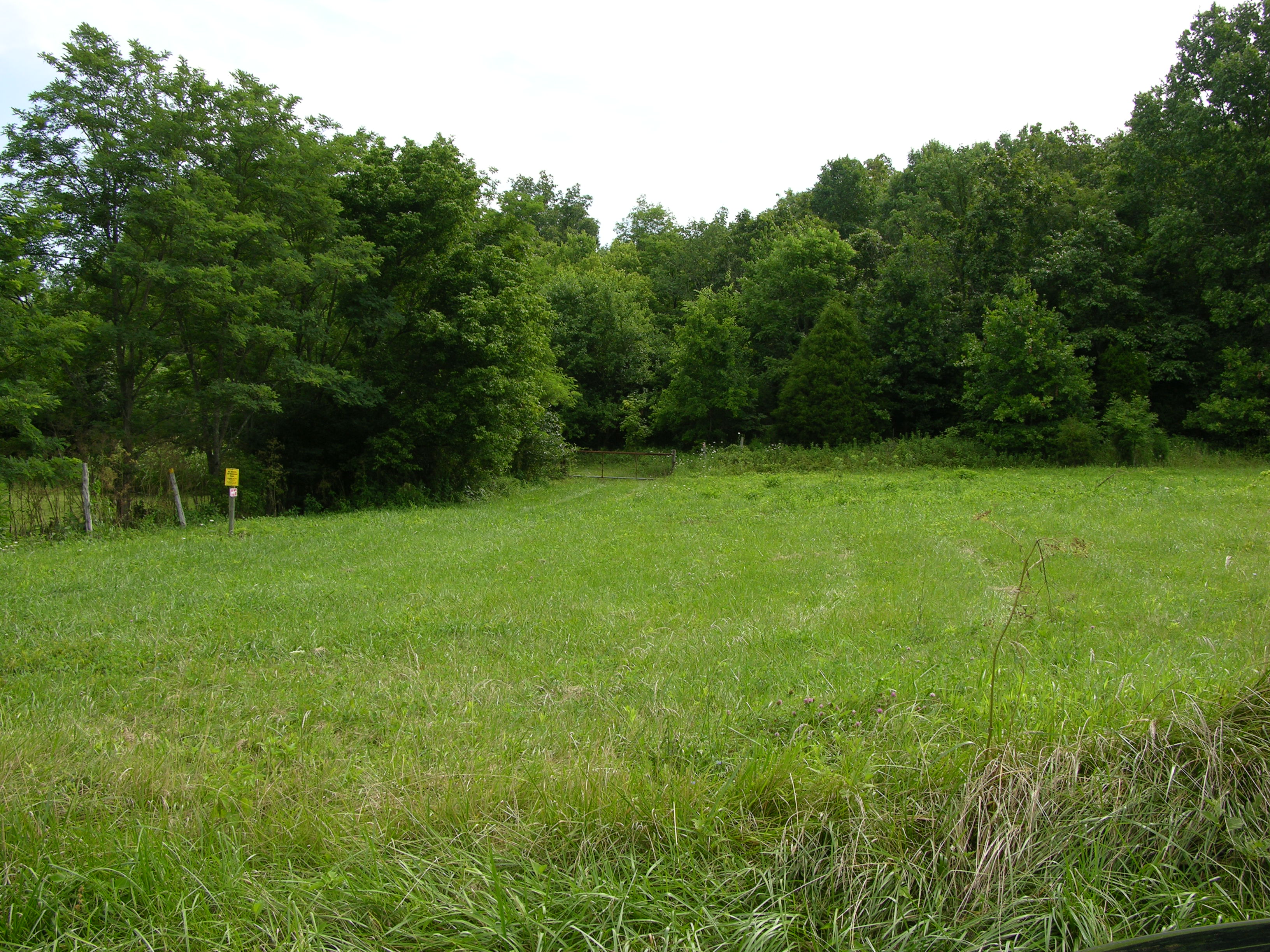
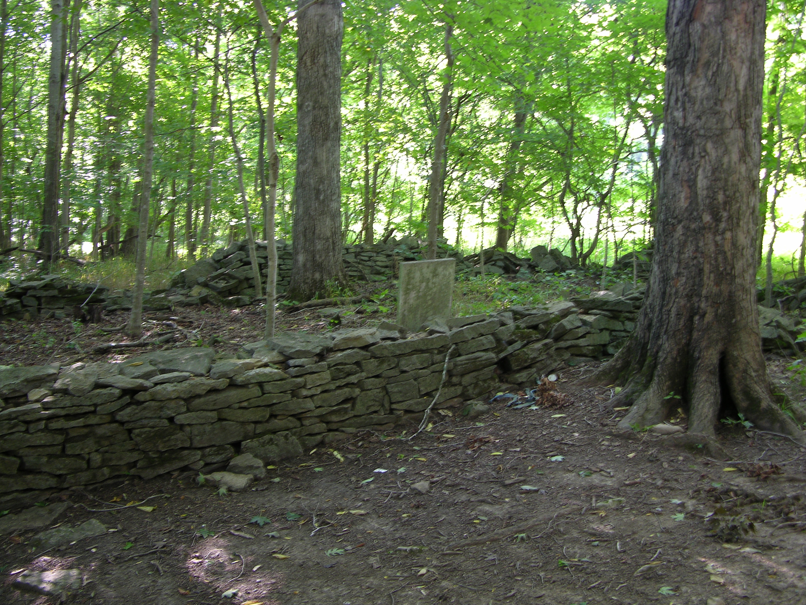
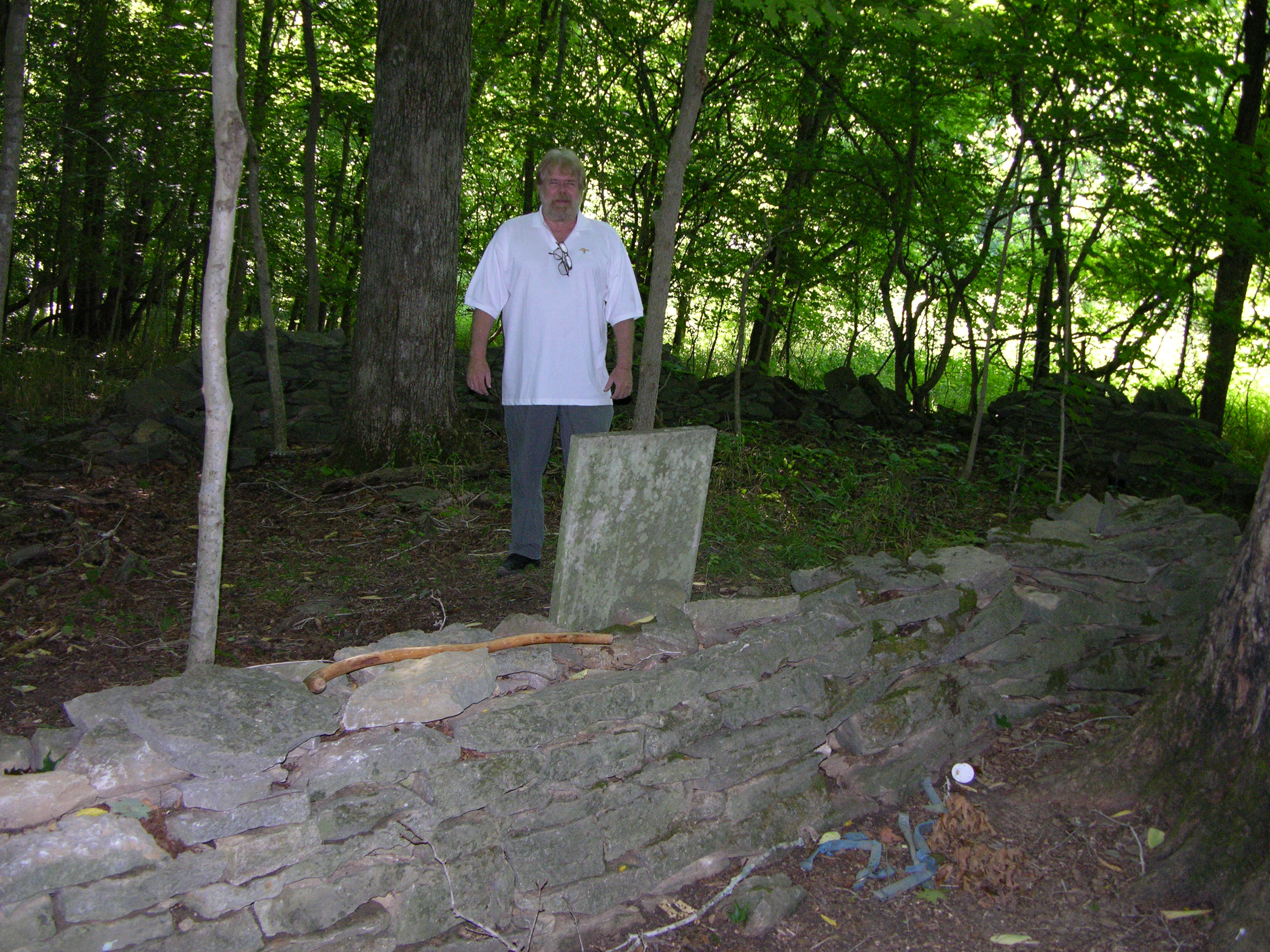
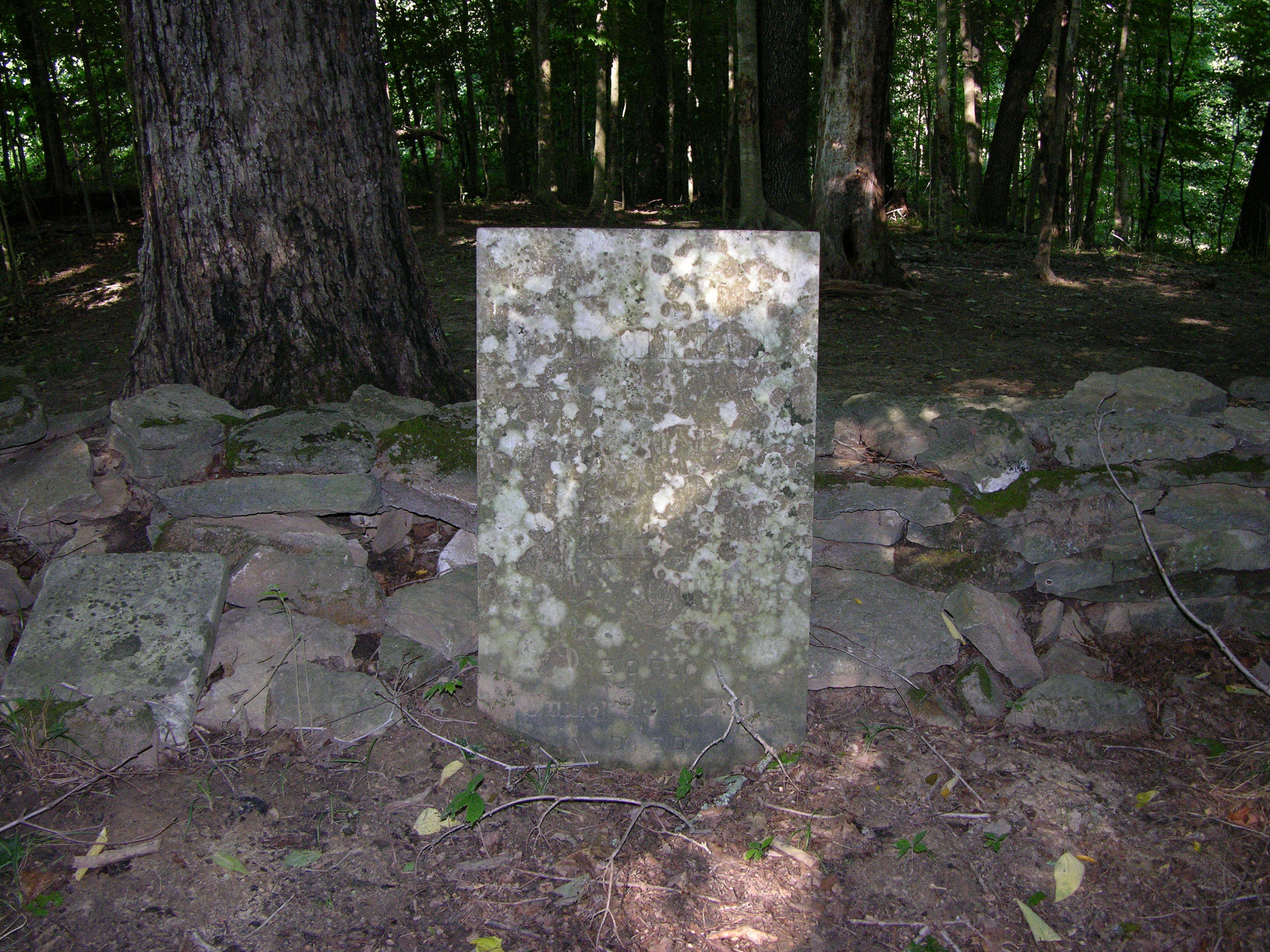
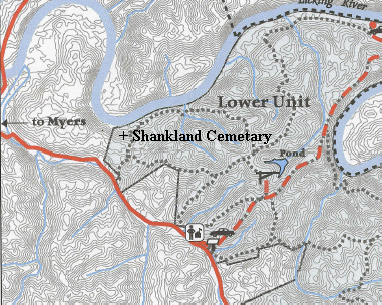
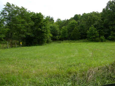
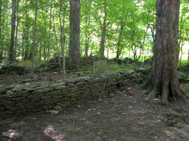
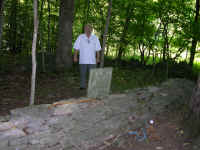
After 4 days of research, talking to some "old timers", and the
able assistance of Kimball Booth we found the fabled Shankland Cemetery along
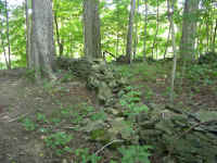
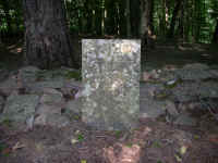
with John and Sally's grave. This is the oldest direct ascendant grave I have
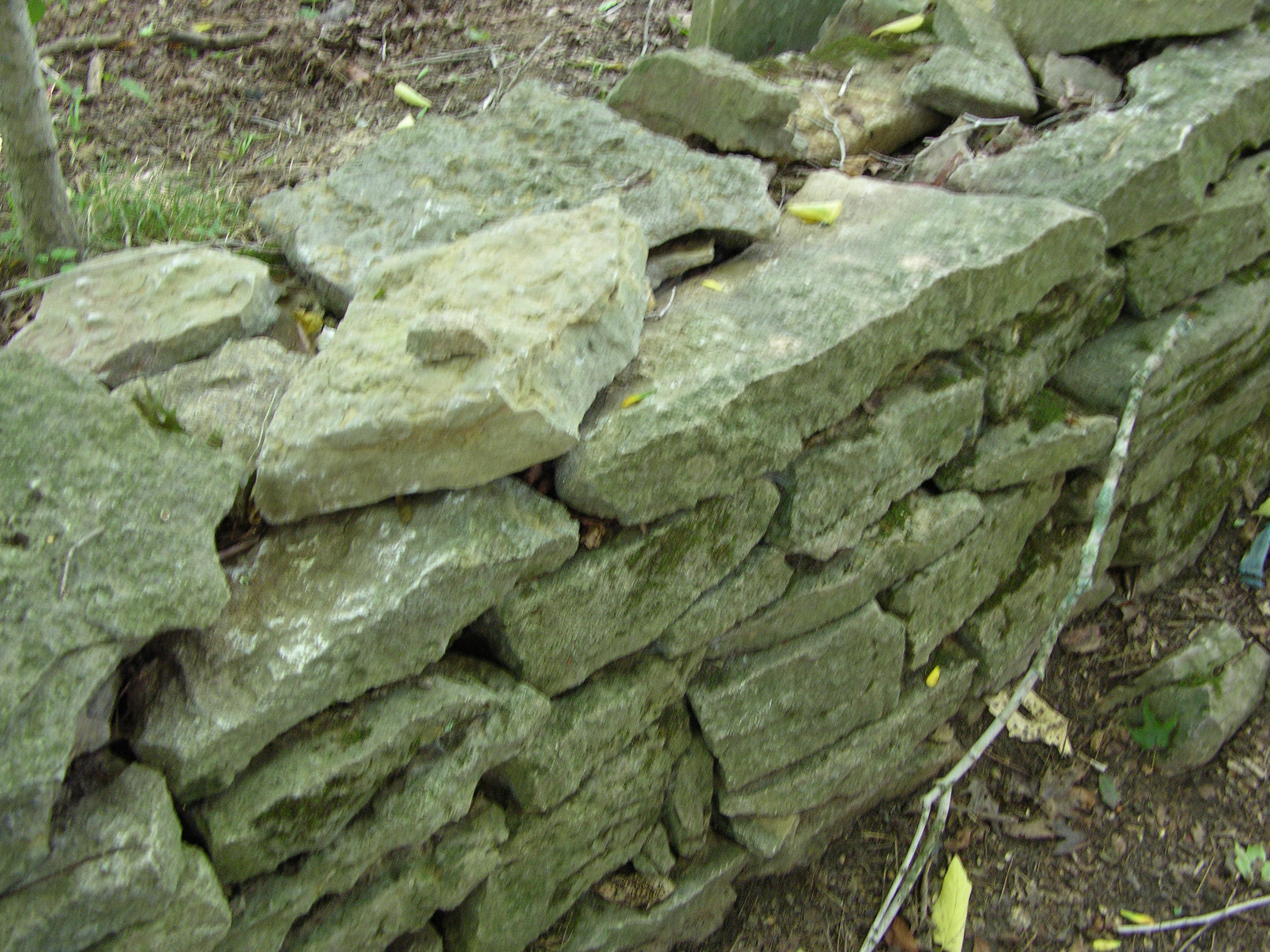
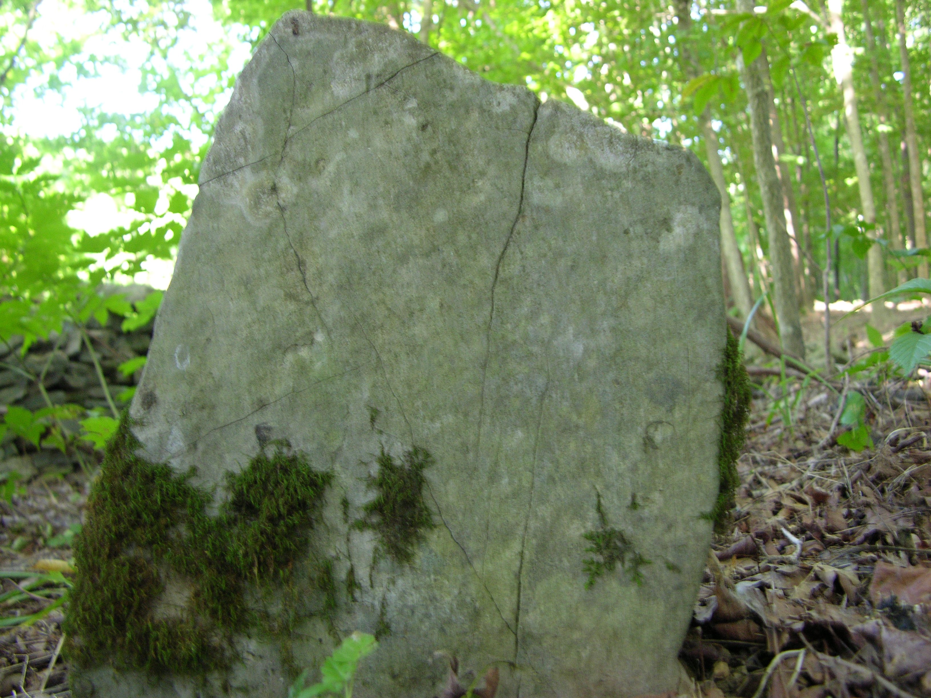
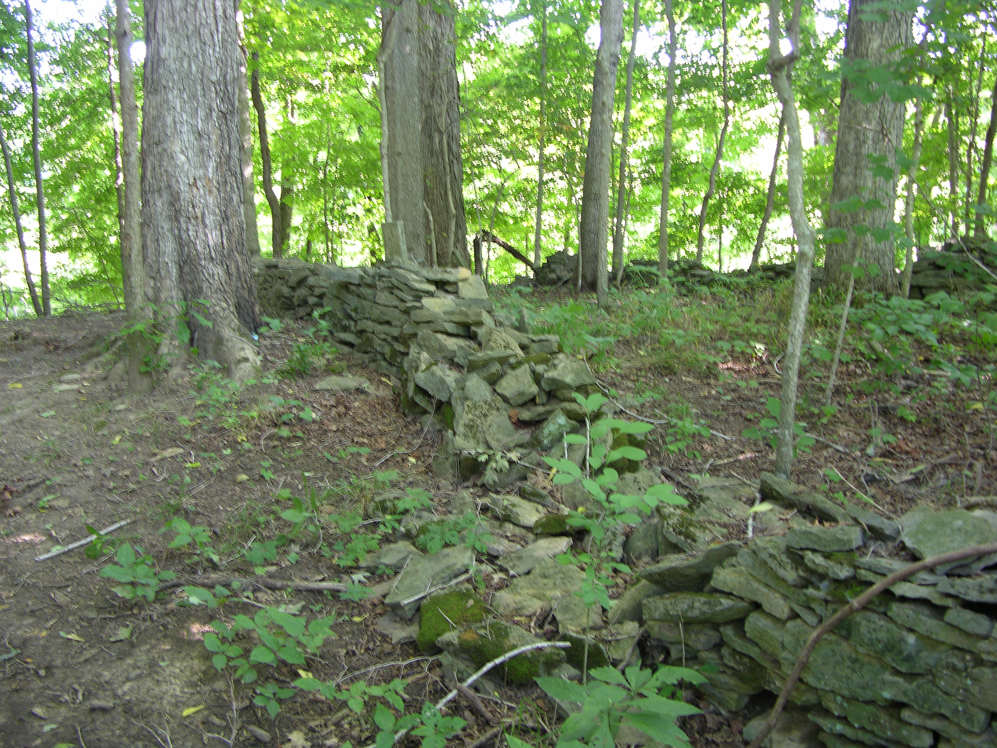
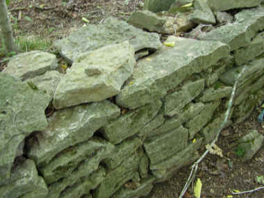
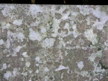
found. This beautiful burial ground is surrounded by a large hand
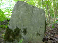
built stone wall. Inside are many primitive style stones and two
"modern" engraved stones. One is for John and Sally and the other for Margaret
Shankland wife of Benjamin Franklin Shankland. At least one of the natural
stones had some engraving on it.
 The
cemetery is located at the top of a hill and overlooking the licking river at
the back. I don't have a modern survey but this site is on the Shankland
property and standing there gives one a sense of where they lived. The property
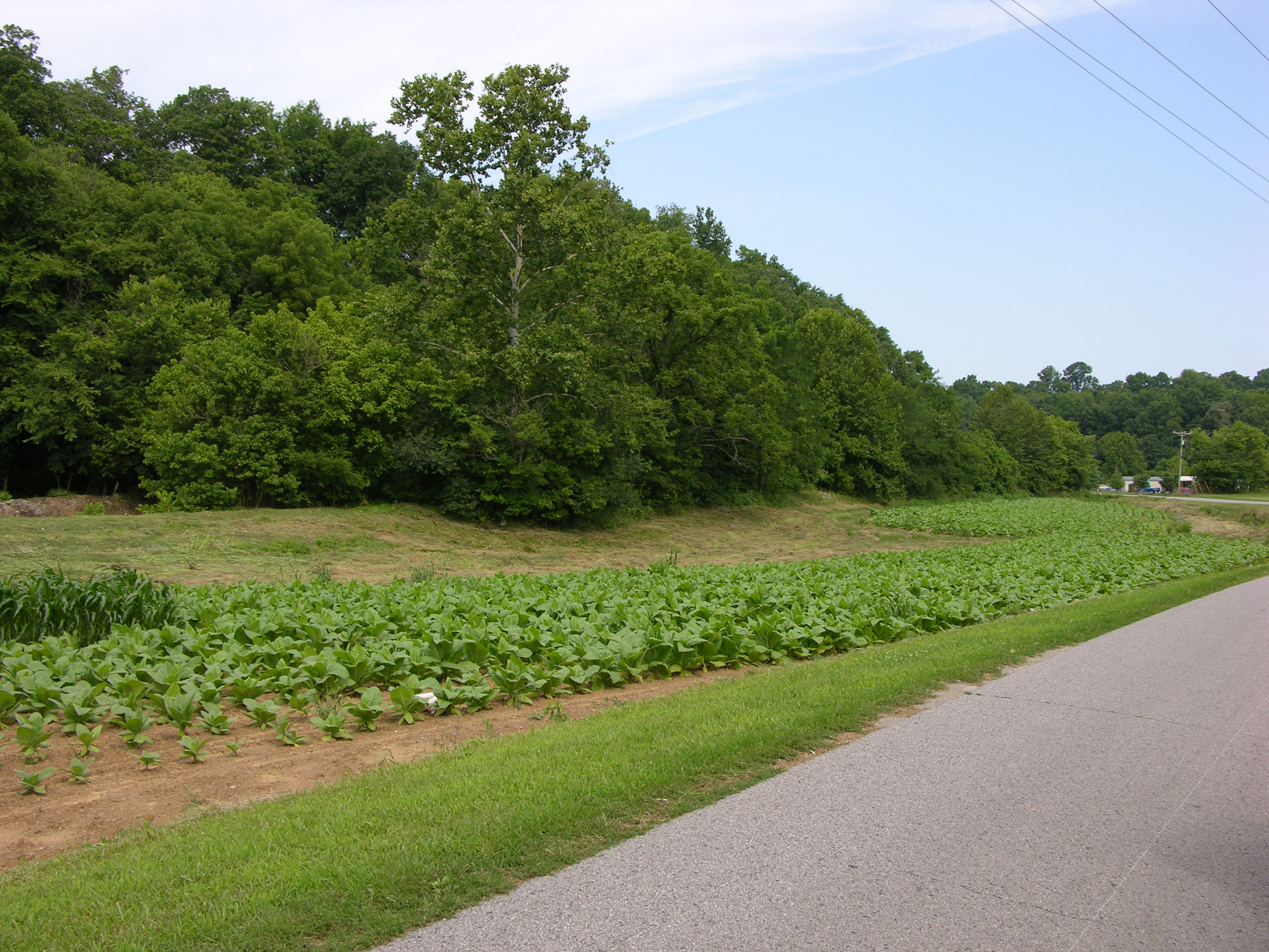
must extend from this site down to Cassidy creek. The WMA has removed the
remains of 5 different buildings nearby but it is unknown if any of them
belonged to the Shanklands. Currently tobacco is being raised along the creek on
the old Shankland home and the land between the road and creek and is still
owned privately. The
cemetery is located at the top of a hill and overlooking the licking river at
the back. I don't have a modern survey but this site is on the Shankland
property and standing there gives one a sense of where they lived. The property
must extend from this site down to Cassidy creek. The WMA has removed the
remains of 5 different buildings nearby but it is unknown if any of them
belonged to the Shanklands. Currently tobacco is being raised along the creek on
the old Shankland home and the land between the road and creek and is still
owned privately.
You may visit this place by checking in with the office on the WMA and have
them drive you up to the site in a 4 wheel vehicle. It is also accessible by
horseback.
The Lat - Lon is 38.3534 -83.9292
 |
 |
| Looking up the road towards the gate to the
WMA and the Cemetery. |
The Shankland Cemetery and the backside of
John and Sarah's Headstone. |
 |
 |
| Stone wall detail. |
John Shankland |
 |
 |
 |
 |
| John N Shankland 7/15/2004 |
"Primitive Stone" |
The Wall |
John and Sally |
|